
It isn't just the patio. For retired people the email has been getting a workout. Normally it's pretty staid. Then I joined the executive of our community association, and the traffic picked up. Then Linda volunteered to do some community development research, and holy doodle! We're all glad she's doing it, and I think at least some of it is fun for her, and we're finding out all sorts of interesting things, but there are lots of documents being emailed back and forth, and Zoom meetings are a regular thing. Just as a hint, having two people attend the same zoom meeting on two different computers that can hear each other isn't a good idea.
The many facets of community development are much in our minds just now. Let me digress a little so you know where I'm coming from. Woodbine and Woodlands were two smallish communities developed starting in the very late 70's. Our house was built in 1984, and I think the last new homes were built in the late 1990's. The two communities merged into one community called Woodcreek, though most people would still say they live in Woodbine or Woodlands. It's mostly single family homes, ranging from starter homes to some extremely expensive homes along the border to Fish Creek park.
Keep in mind as you read along that there are many annotated photos below.
You got here by Anderson road. Until recently it was a 4 lane 80 kph road. Or you came down 24th St, another 4 lane road, but 60 kph. Woodpark Blvd was T intersection off Anderson, and 130 Ave was a T intersection off 37 St. When we moved here Anderson road turned into a 2 lane road at 24th, and you could turn left onto 37 St, go down the hill to a 90 degree bend, cross a one lane bridge, do another 90 degree bend, and carry on through rural roads to 22X. There was a huge green space between Woodbine and 37 St. HUGE! Even then it was well known that eventually the road would be widened, and there were signs to that effect along the green space.
Then development started south of Fish Creek, and they wanted a better road to carry the traffic north. After much fussing 37th street and the little bridge was replace with a 4 lane 80 Kph highway that curved around to Anderson road. The theory was that it would be further developed to be part of the ring road, and some hypothetical path would be found to join it up to Glenmore and Sarcee trails. Somewhere. Somehow. Going over, or below, or around the sensitive wetlands of the weasel head, and somehow dealing with the Tsuut'ina First Nation. This hypothetical road has been discussed for most of a human lifetime.
That hypothetical road is becoming a reality and some of our neighbours are losing their shit, and I can't say I blame them. What broke the logjam was the Tsuut'ina deciding to swap some of this land to build the road on, for some land on their west boundary. There were lots of people surprised by this, me included.
That changed everything. Now the road builders had a huge swath of land to work with, and a multi-billion dollar budget to work with. With that sort of money involved, I have not the slightest doubt there are all sorts of deals happening ought of sight of the taxpayers.
We had thought the existing highway would be added on to, some intersection tweaks, a few more lanes, and Bob's your uncle. They essentially threw that road away and built another one on top of it. Quite literally. That highway was quite a bit lower than a sound berm. Many houses were built backing onto that green space, and for decades they had a nice mountain view. People walking on the top of the berm had an even better view of the mountains, and the back yards lost a bit of privacy. Many homeowners planted some trees or shrubs, and it all seemed to work out.
Now the road is going to be much higher, especially as an exit ramp curves around to eastbound Anderson Road. The road will end up being only slightly below the existing berm. Homes that had a berm and view of the mountains, are now going to have a view of trucks going by only a few meters from their windows, as part of a major intersection. Nobody quite knows if there will be a sound barrier installed, or if the berm will be raised. Neither of those particularly enhances the value of those homes. The owner of that home says their home is essentially worthless now, because who would buy it? Only someone with a traffic fetish.
Just a little further south of that, is a new pedestrian bridge. I ought to put that in quote marks. There is a new pedestrian bridge over Anderson Road just to the east of the new intersection. It's a nice looking metal arch bridge going over what used to be 4 lanes of traffic, and will soon be 6. I'd have to measure, but I think the bridge deck and approaches are 3 m wide.
The new bridge being built now is enormous. It has to cross the space to contain 16 lanes of traffic with generous space between the traffic streams. It has to be 5.7 m above the road surface, which itself has been raised substantially from the old road surface because of complicated reasons. The approach ramp is 4 traffic lanes wide. The bridge deck is supposed to be 3 m wide, plus a meter on either side for guardrails and curbs and whatever. I have to say it looks much wider than that.
There are rumours that it was built this way to accommodate emergency vehicles, or transit to Tsuut'ina, but neither of those makes any sense. I heard in a Zoom call that included our local MLA, that it really is just a pedestrian bridge. But the people that live immediately east of it have essentially unsalable properties as well. The deck of that bridge is about roof level on the nearby houses. From the back decks and patios, the view will be a concrete wall only a few meters from your back fence.
There are about a dozen to 2 dozen homeowners seriously affected by the road development. Everybody in Woodcreek is affected a bit just now from construction noise (I'm listening to the tracked earth movers, dump trucks, and the beep beep beep of reversing vehicles), but that will be replaced by the hum of traffic that will be distant for some, and up close and personal for others.
So getting to the point here. There were presentations about the new road development. Many assumed that it was a done deal, though there were some protests. There are active discussions about what, exactly, has been changed since those plans were presented. I have to say, at the least, that the new road comes considerably closer to the homes than I recall, at a considerably higher elevation.
How do we as a society balance the needs of an overall community against those specific people affected? Should a few homeowners be allowed to completely stop development? How much delay for discussion of alternative proposals should there be? Who decides?
The problem with road development is that if you build it, the cars will come. The new Stoney Trail on the east side of the city was thought to be a white elephant that nobody would drive on. Last I checked, it had traffic backups, and Deerfoot doesn't seem to have any less traffic. All those cars came from somewhere. I'm sure once our chunk of the highway is connected up to the rest of the ring road, there will be lots of traffic.
Our neighbours are coming to the bitter realization that road is getting built, come hell or high water. Part of the deal is that if it isn't open to traffic by a certain date, the land reverts. Why the Tsuut'ina would want it back other than to charge tolls, is beyond me. They have billions of dollars of development planned that is based on having a functional highway. The discussions now seem to be about berms and sound barriers. We were at an open house last night, and one of the comments was that we don't need this road, and certainly not 16 lanes of it. Sorry, but that ship sailed long ago.
Calgary is addicted to cars, and keeps on building more roads, to serve the ongoing urban sprawl. Worse, the sprawl doesn't even pay for itself. The cost of servicing the new communities is more than the City gets back in taxes, and yet it has to maintain the expensive infrastructure the developers installed, over an ever increasing area. No wonder our taxes keep going up.
So what happens? People are busy with their lives. They don't know about the preliminary planning meetings to plan the functional plans that will drive the actual development plans that will be presented to the stakeholders. By the time any of this comes to the light of day, its much to late to protest. But trying to protest earlier is difficult, firstly to know to protest, and second in the face of the response that nothing is decided yet. Except it is, the powers that be are just deciding the details of how to divide up the pie.
Trying to get people involved in decisions that affect them is difficult. An example. Our community association facility is closed during the pandemic. We are getting to the point of being able to open it again, sort of. There are all sorts of general guidelines available, but we have to decide how they are applicable to our particular situation, and come up with the specific policies for our facility. We then have to publish those policies. The people on the executive are all busy people already. Our facility manager is assumbling documents, but quite rightly wants someone on the Board to help make some policy decisions. We asked last night. Crickets. Eventually one person stepped up.
There are so many development issues in Calgary now. Completing the ring road is a done deal, just the construction to be completed and cheques signed. There is the arena boondoggle. The Green line looked like a done deal, but there is a new wave of protests. I find it ironic and infuriating that a deal that enriches the already wealthy is fine, but building public transit for the masses is "too expensive". There are all sorts of densification projects on the go, where the older inner city homes are being torn down and new buildings being put up. It isn't just infills, the developers are buying several adjacent lots and putting up multi-story condo buildings. Lots of people are upset about the loss of the character of their neighbourhood.
About that loss. Once a residential neighbourhood is built, are we locked into that? Can we never put up bigger homes? Can we never combine lots to put up more efficient housing? Or only do a certain amount of it? How much, then? What about dealing with infrastructure issues? Parking is often mentioned, but addressing the increased water and wastewater requirements is essential.
Woodcreek is a long way from having that sort of development happen. At most we've had a few big expensive homes torn down and a bigger even more expensive home put up, sort of a wealthy person's game of one upmanship. But it is coming. Homes have a lifetime. At some point a new owner looks at it and decides the cost to bring everything up to current code is more than knocking it down and putting up a new building. So neighbourhoods will gradually change. Lots of it is happening just north of the reservoir, were many of the homes were built in the post-war years and would require major work to be brought up to code.
When I first moved to Calgary there was discussion about ripping out several old neighbourhoods to put in new freeways so people could get downtown to work faster. There were huge protests and the plans were shelved. Perhaps if Woodcreek had known the full scope and impact of the ring road just to the west of us, perhaps there would have been more protest. I don't see any real reason why the road couldn't have been built at an elevation similar to the old road.
So the promised photos. I started with a 14 mm lens, this is really wide, and makes things appear small and far away. Where possible I tried to get something to scale the photos.
1. This is the approach to the existing Anderson Road pedestrian bridge, taken from the sidewalk.

2.Going up towards the bridge.

3.Bridge deck. Supposedly 3 m wide, but I haven't measured. Thats pretty close. It goes over what is now a 4 lane, currently under construction, soon to be 6 lane road.

4. View from the south end of the bridge, looking west to where the interchange will be.

5.Centre of the bridge looking east.

6. Centre of the bridge looking west.

7. Another view of the bridge and road. I think it's a nice looking bridge. It's well used. I had to wait for people to cross to get a shot without them.

8. Beside the approach.

9.Another view of the approach, taken from the side of the street. This is the bike path.

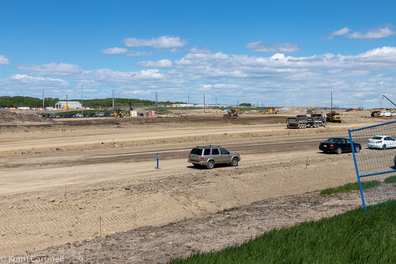
10.Now we're further along the bike path looking south and west towards the new pedestrian bridge and the ring road construction.

11. A closer view. The approach appears to be 4 traffic lanes wide. We were told this is because of the construction method chosen by the contractor. It didn't need to be this big.

12.

13. Near the start of the approach to the new pedestrian bridge.

14. The path between the approach on the right, and the homeowner fences on the left. This path probably isn't quite 3 m wide.

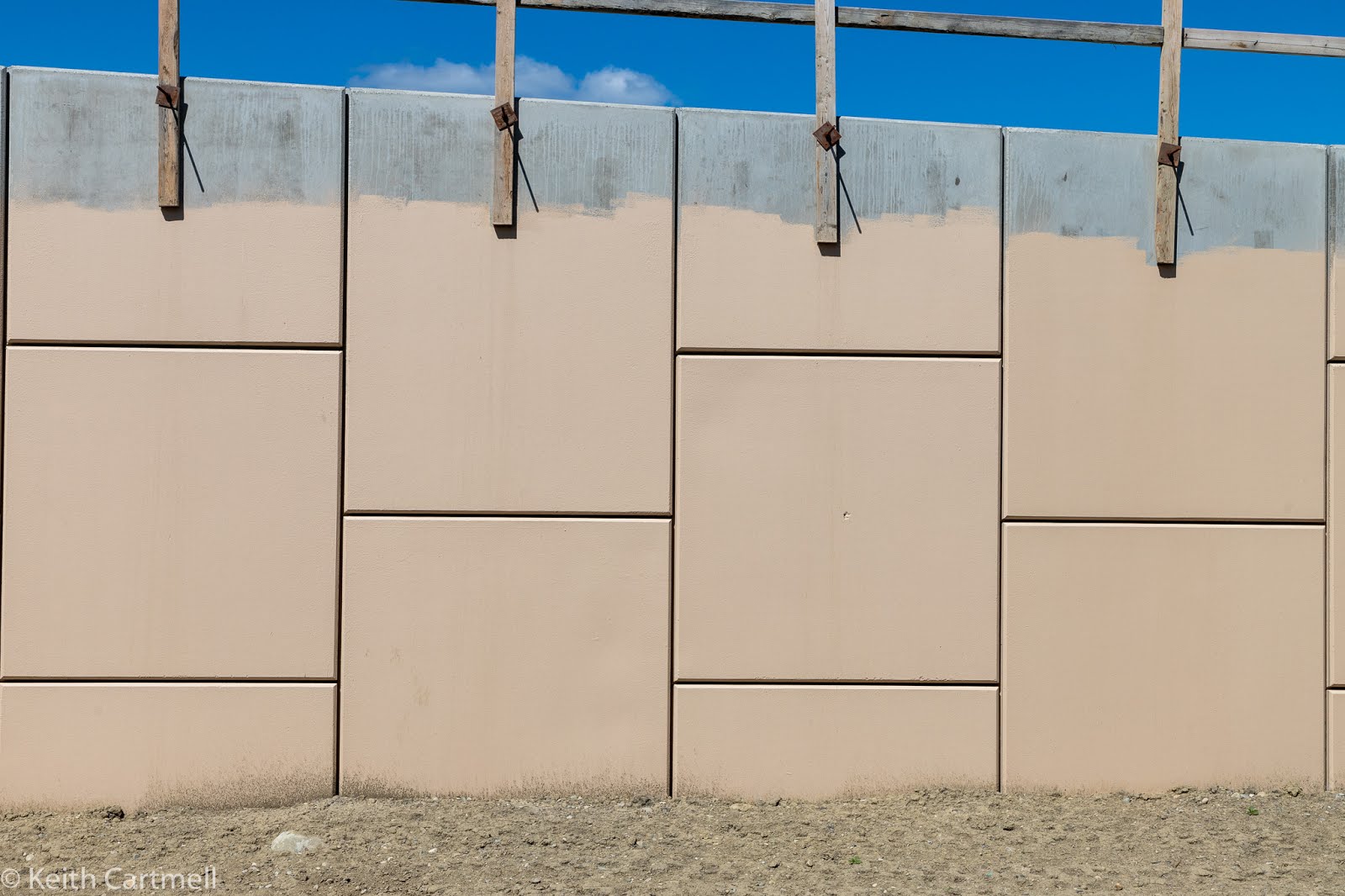
15. I was standing with my back to the fence. The wall directly ahead of me is probably about 10 feet high. That retaining wall is much closer than it appears.

16. A little further along, standing against the fence. The blue construction fencing is about 2 m high, to give you a sense of scale.

17. The start of the actual bridge.

18.

19. The bridge itself, with some trucks and construction vehicles for scale. I changed lenses and am now shooting with a lens set to 50 mm. This is considered 'normal' and roughly equivalent to human vision. Supposedly the actual pedestrian part is 3 m wide, and needs another meter on either side for curbs and railings. Does this bridge look 5 m wide to you?

20.

21.

22. Standing against the fence, trying to shoot level, but this is actually pointed up a bit. Remember, the top of the blue fence is about 2 m.

23.

24. More of the pathway.

25. Standing against the homeowner fence. That section of retaining wall is about 10 feet high.
26. Another shot of the path, with a cyclist on it. People on the pedestrian bridge will be able to provide roof inspections for several of the nearby homes.

27. I've moved a bit further north along the bike path, and this photo is looking north and west, to where the old T intersection with Bullhead road used to be. I would run down the berm quite aways, cross 4 lanes of traffic, and run up the hill on the other side.
28. This is one of the oldest houses in Woodbine. It used to have a beautiful mountain view. The next photo is taken from the same place, turned about 90 degrees.

29. This is their view now. The mountains are just visible. Note the trucks, they are on what will be the exit ramp from northbound ring road to east bound Anderson.

30. That truck is on the exit ramp

31.

32. The people looking out the window of this house could see that truck. A kid could throw a small stone from the yard onto the ramp.

33. From the same place, the ramp under construction. You can see the sound berm isn't much higher than the road. The road used to be maybe 10 feet lower, and a lot further away.

34. More construction.

And there you have it. Thoughts about road construction, community development, and patios.
I don't blame people for being pissed off. You'd think you were in Texas. (You know, where everything's bigger just because.)
ReplyDelete